Pouakai Northern Circuit

A wet and miserable Waitangi Saturday on Mt Taranaki. Here I ascended my favourite ridge, the Razorback, and climbed Jacob’s Ladder. Now on the Round-the-Mountain track, it was a downhill splash past the Dieffenbach Cliffs and across the Boomerang Slip to the hut. Wet & warm in only my polyester t-shirt and a buff, I had entered the comfortably drenched zone that all runners come to love, perhaps after some persuasion. I saved my Goretex jacket for later in the night when I’d need it most.
On my whistful way to Holly, I befriended a hunter along the trail. Not quite by choice… He looking for his lost dog. I had lost his dog.
As I dashed around one typical corner, a moment of panic struck this hunter’s dog. Was I here to steal him from his master? The trail was narrow, as I approached at speed the dog chose to race off away from his owner. He was gone.
We found the city dog sleeping at Holly Hut. I had scared him on his first run  in the bush, and he scampered off in fear. Fortunately, he was able to follow the scent of hot food to the hut.
I, however, had to keep moving, otherwise hypothermia was going to get the best of me. 6pm, I was one third through the 3 day tramp. Just over 1 hour had elapsed since I had left the North Egmont carpark.
After crossing the Atakawa swamp, swampier than ever, I began to ascend the ridge to Pouakai Hut. Once a slippery grovel in the mud, I was grateful for the stairs to carry me efficiently to the Pouakai plateau. The views were spectacularly white.
The Pouakai circuit was a great little run that takes in some of the better trails of Taranaki’s upper circuit, combined with some rough but exciting bush running in the Pouakai Ranges. On a clear day, the best views of Taranaki would be had from the Pouakai’s, as well as along the vast eastern coast towards Raglan. We live in a beautiful country. You can’t always see the beauty as you might expect, but on a wet & wild day on Taranaki you can definitely feel it!

A Glitch in the System

After a prolific year and a monumental summer exploring the mountains around Nelson and Taranaki…

Road tripping down the North Island…
Running to the summit plateau of Mt Ruapehu…
Battling the misty Tararuas to claim Mt Hector…

Soloing Nelson Lakes’ Travers-Sabine circuit in a weekend…

Surveying the mighty peaks of Arthurs Pass…
Going Syme to Syme around Mt Taranaki…
… my adventure streak has finally ended. 

While barefoot running along the slippery Okura coastline, my toes lodged into the sand and I suffered a painful, twisted landing. As I fell, my knee twisted and wrenched delivering a double shot of hyperplantarflexion to my left foot. I lay writhing in a salty puddle, hoping I could walk it off…

Only Okura? Never under-estimate the Okura. 400m past this point, and it was all over.

Luckily, this was a fundraising walk for the AUTC Oxfam Trailwalker team, and I had the choice of 40 trampers to carry me the 3km back to the Stillwater carpark. Exhausting work just hanging on while my limp foot began to stiffen and swell; I was glad we weren’t any further from the road. [Yes, a gentle reminder about safety in the outdoors…]

Despite life in crutches being hard work and often frustrating, there’s still plenty of adventure to be had. Inability to run doesn’t mean I’ll get fat – climbing the hill from Britomart to University makes for a huge upper torso workout, by the end of the day my shoulders are burning under the stress.  

One of the many skills to be mastered on crutches

There is never a “convenient” time to be injured; it was likely to happen sooner or later. In my mind, it is better to be injured now while studying in Auckland than while ploughing through the mountains of the South Island.

The 24 hour adventure race in Northern Coromandel involves sea-kayaking, mountain-biking, running, and navigation. As well as a few mystery activities! Which will remain a mystery for now…

I’ll be postponing my entry to the world of adventure racing – this weekend’s “Jurrassic Arc” 24-hour adventure race in Northern Coromandel will go on without me, but with Edward Lawley stepping in its a relief that the team isn’t affected. Go team Celebrate the Day!

New Balance MT110 – only available in USA. Time to make a truce with your mates in the states.

An extra kick to the guts, my much anticipated pair of New Balance MT110 trail running shoes arrived from BOULDER, COLORADO the day after the injury. New Balance is getting excruciatingly close to creating the perfect shoe – partly designed by Anton Krupicka himself. Sporting a 4mm heel drop, nicely balanced tread pattern, more durable side mesh, and weighing only 230grams, these shoes are ace. At least I’ll be able to crutch around in style.

Syme to Syme – Around the Mountain

If summiting a mountain was to conquer it, then circumnavigating a mountain would be to invite him over for dinner, have a drink,a good laugh, and raise a toast to his sunset.
On Saturday February 18th, Ben Duggan & I joined Mt Taranaki for a mountain running smorgasbord buffet, and we ate the lot. From Syme to Syme, in a day…And what an adventure!
 
Our goal was simple, to run the ‘Upper Mountain Circuit’ of Mt Taranaki – but another burning desire of mine complicated things… Syme Hut, the highest hut in the North Island was just waiting for  us to stay a night. So we stayed two. Perched on top of Fanthams Peak, Taranaki’s side-kick, we had inspiring views on a clear Friday night as we fuelled up and prepared for our giant Saturday mission. 

5:30AM, I ducked my head outside Syme’s ice-pick studded door. A streak of orange on the horizon ignited the spark of sunrise as we began our epic: AROUND THE MOUNTAIN. We out-ran the sun to the western side along the Brames Falls Track, overgrown and clearly unused even though it has some amazing scenery. Precipitous cliffs fell from Bob’s Knob, one of the many distinctive rock formations jutting from Taranaki’s higher flanks. I clung firmly to lava rock as I dropped into one murderous valley, you couldn’t afford to be half asleep on a trail like this.

Pumped – Bring it on!
Before it became unbearably hot, we dropped down along a ridge, and into the rugged western jungle. We scampered our way through vines and branches with relentless forward progress. Waiaua Gorge Hut brought back foggy memories of our long, wet tramp around Taranaki in the heart of 2010’s winter. Memories of the drenched bush were soon wiped dry, it was developing into a brilliant day with clear glimpses of the Mount bursting into our scene.
Heartily climbing out of Waiaua Gorge

We avoided the chasm of mud and micro-climbs that I knew were hidden beneath the even contours below Kahui Hut, this cut a wholesome chunk off our time up Stony River to Holly Hut. All the while, Ben was developing some serious nausea and hadn’t been able to stomach anything solid since breakfast. Not good. He almost vomited while I gratefully chowed down on fried eggs offered by some frisky hunters. Though delicious, I could appreciate he was wrenching in agony and putting up a brave front. We discussed pulling out at North Egmont, without fuel Ben’s energy levels were deteriorating fast. A hard decision to make…but we pushed on.

Empty stomach perseverance: Up the Stony River.

Somehow, the 500m climb to Tahurangi cured him. When I first heard the words “…let’s stop for food…” I knew we’d make it. We were now running true ‘around the mountain’, for miles in the distance the sidling trail was clearly etched into the mountain-side. The crest of every spur brought with it new views and new hope of finishing. But this was it: the uncertainty of completing your goal in ultra marathons is exactly what makes them so elusive, and keeps us running back for more.

Getting into my rhythm on the climb to Tahurangi. Dieffenbach Cliffs in the backdrop.
Faintly humming gliders swooped above us as we cut past Tahurangi, and the teeming masses returning from ‘Summit Trail’. My favourite section of track followed, and we really opened up our hinds for the first time. It wasn’t long however that I remembered  – the major 1074m ascent of Fanthams Peak that I had saved for lucky last… 
Stratford Plateau. Fantham’s now in Sight.
After 10 hours of tough, tough running, we needed every mental boost we could get. After all, there’s only so much PowerBar one man can handle.
Something special about Wilkie’s Pools. A highlight of the trip

Getting emotional at Sir Ed’s memorial. Not far to go now…

 Knocking off the downhill through Manganui ski-field, the glorious Wilkie’s pools, and into Dawson’s Falls set us in high spirits to end the day – we were now amped on endorphins – determined to fling ourselves at the stairs – literally 1000 of them – fourty minutes later – – –

Ben – ecstatic
BOOM! 
Round the Mountain, no mean feat

We were over the moon, and had clocked in at a fraction under 11 hours. Although truly impressed at the thought of Grant Guise’s recent time of 6 hours, we were about to complete a known first. Because as we lay elated on the steps at our loop’s end, the chilling sweat on our backs reminded us our journey wasn’t yet over…

Absurdly destroyed. Scoria was not designed for tired legs

Forty-degree pitched fields of loose scree almost had the last laugh – the extended stop had sent us writhing in cramp as we summoned emergency pockets of energy to help us make it to the top. To make matters worse, cloud engulfed us for a time, not unusual on these slopes but all the more demoralising.

Home at Syme Hut, again
After enough moaning, the hut was not fantasy but once more a reality. The effort invested in the eight-dollar bottle of Corbans Merlot was well worth the trouble, and we lay back contentedly as we watched another prolific day end. We hobbled barefoot over the scoria to watch the sun achingly dip into the Tasman. Exhilarated, and broken. We collapsed inside the hut for a long time.

Taranaki – Like no other…

Mt Taranaki – #1

After several failed attempts to climb Mount Taranaki, at 7:23pm Tuesday 31st January 2012, I reached the summit. Perched on a windy rock at two thousand five hundred metres, I was there in the moment. At last!

Magical

During the weekend, the mountain was taken by storm by Anna Frost, Matt Bixley, and Grant Guise. They each smashed records on the mountain, some had stood since 1976. I spent Saturday cycling around Taranaki, and was too depleted to join their record-breaking attempts. Read about their success here: Mt Taranaki – Speed Record. Alistair McAlpine has recently compiled all the records on the mountain, hence the recent interest! I was determined to make my own way up at the first open chance…

Today began windy & wet, but as I patiently stared outside my office window, mentally tearing away the layers of dark cloud, the storm began to subside… I was just about to think of another plan when, the rocky peak appeared above the clouds. All go!

I set off up the Razorback track from North Egmont at 5:50pm, following advice from 4-summits record holder Matt Bixley. Overgrown, and laden with hundreds of steps, I climbed steadily along a ‘razorback’ ridge to the Translater tower  by Tahurangi Lodge. 35 minutes, I branched off to the summit climb section.

Stairs…

A few hundred steps launched me into the nemesis of the climb – 300 vertical metres of scree. Not your average scree, with hundreds climbing this route every summer weekend, it was all but impossible to get a grip! As I climbed and clawed desperately, I started to pick a better route between well lodged rocks, but it was still a huge mission. Once at The Lizard, it was a rock climb scramble to the crater. My watch spurred me into a furious dash once I saw the ice in the crater, ticking down to my goal of 1 hour 30 minutes…

Head down until I saw the memorial plaque, what an epic view to burst through my senses! 1 hour 33 minutes to the summit, I was ecstatic. Reminding myself this was only the first, the reccie, I’m sure there’s plenty more to be shaven off.

The summit crater

I didn’t rush the descent, it took about the same time as the trip up. Facing down, you realise how steep Taranaki is, and precarious pockets of scree on the solid, serrated rock are forever out to get you. This mountain is just as lethal in summer as it is in winter.

I arrived back at North Egmont at 9:05pm just before dark, making for a 3:15 return trip. It was a magic climb, as I drove off I occasionally caught sight of its darkened silhouette on a surprisingly calm night.

I’m now looking forward to taking 10 others with me to climb the Eastern Ridge on Saturday, and sleep at Syme Hut atop Fanthams Peak. Lets hope the weather agrees! But for now, I can finally live in Taranaki, and relax.

.

Abel Tasman

In my penultimate South Island trip of the summer, I decided to visit Abel Tasman National Park. After all, it would be a crime to live only 1 hour from the golden shores of Marahau without dipping my toes in the sand.

I jogged into the National park expecting beautiful beaches and sea-side relaxation – but once again, I succeeded in making the easiest of the ‘Great Walks’, into a rip-roaring adventure with uncertainty lying around each corner.

I started out with a couple from Wellington as they began their 3-day northern hike, but within twenty minutes, I was bored and my eyes were drawn away from the trail-highway, to the seductive coastline. I strode along a dozen beaches while hundreds of holiday-makers sailed, swam, and sand-castled. Meanwhile I revelled at being off the beaten track once again, boulder hopping around the rocky coastline and occasionally squeezing through tight caves.

Eating nectarines in the shade of the cool forest at Watering Cove campsite was excellent, the air smelt like summer. Golden.

After a leisurely trip north, I ducked my head into Anchorage hut – lifting my Hut Bagging total to over a half century. Though on most hot days of summer the hut would be the last place I’d want to stay, a sleeping bag on the beach would be all you need for a great night sleeping under the stars.

Each clearing through the cool forest revealed a new hidden bay waiting to be explored. Judging by the huge number of kayaks at each cove, the sea-borne travellers were getting the best of it.

 Dirt-crete: thousands of tourists pound and compress this trail into a fast, yet exceptionally hard running surface.

 Seals and White-faced Heron were rampant along the coast, hissing and inhaling violently as I burst into their territory. Threatened, as I cut the line between them and their offspring, I sent the oily creatures flapping into the ocean … safety, for us both. Meanwhile, I managed to capture our mutual fear as we dodged and darted each other along the narrow strip of traversable terrain.

I present to you, In the Hall of the Seal King.

The sunset was a mere reminder of the epic-ness had that day. Wood-fired pizza with a band of Dutchmen, couldn’t be better!

Nelson Lakes

The classical Nelson Lakes view: Lake Rotoiti from St Arnaud

Nelson – the top of the south. So its fair enough that it hosts the magnificent Nelson Lakes National Park – the northern-most strain of the Southern Alps.

Despite their grandeur, I couldn’t find anyone to accompany me on the ambitious journey I’d set through the park this weekend. So I took to the mountains solo. No need to worry, I was well equiped, into my new 25 litre pack I stashed a sleeping bag, goretex jacket, a few thermals and plenty of food. A short ninety minute drive from Nelson to Robert Ridge, I left straight after work and was on the trail by 6pm – onwards to Speargrass Hut!

Crossing the Speargrass Creek bridge to the hut

Stage 1: Robert Carpark -> Speargrass Hut (1hr15)
No time to lose, I was off. Still getting used to running with a 6-8kg pack on my back, I had a leisurely jog to the hut, sidling around the head of Mt Robert and alongside Speargrass Creek. The hut was perched in an open clearing of, surprisingly, speargrass – late evening cloud hung around the epic looking gulley towards Lake Angelus… I decided to call it a night here, and rest up for the big trek tomorrow.

Israeli Man saying goodbye at Speargrass Hut

I shared a breakfast of PowerBar muesli in a bag with an Israeli couple, and a British tramping family who were forever asking their son Thomas to kindly brush his teeth. Too bad I’d ditched mine – unnecessary weight! The water was so pure, my teeth were cleaned to mountain-stream fresh breath standard.

Stage 2: Speargrass Hut -> Sabine Hut (1hr40)
On the road at a spritely eight o’clock, I took to the gradually declining trail to Sabine Hut with gusto. I passed a few small forest tarns along the way, uniquely out of place. In the huge scheme of time, I cut through the still forest as a momentary blur.

Blue blur through the greenery

Was this a great mass of blue sky appearing through the trees, or the huge still expanse of Lake Rotoroa? The air was still but for the irritating buzz of sandflies – I avoided being their morning tea and spent mine swimming in the lake. Cool and refreshing, I drank as I swam. The lake’s surface coated in spongy moss gave my feet a good massage before moving on down the Sabine River.

Early morning bath at Rotoroa

Stage 3: Sabine Hut -> West Sabine Hut (2hr30)
Travelling down the true right bank of the river made for an idyllic run. It felt like true South Island, open grassy patches with views down the river to the high 2000m peaks still holding snow at the tops. The track was mostly flat, except for a few “step-ups” as an Australian tramper put it, the trail was fast going helping me to cut the tramping time to West Sabine hut in half.

Cairns lead the way
Taking a break by the river

To cross the river though, not quite so easy! – the bridge had been smashed in a flood, and the warped wreckage was still hanging in the blue rush. Thanks to some local knowledge, I found  a log conveniently lying across the river, which I waltzed across. As it turned out, this one broken bridge would affect almost everyone on the circuit and everyone planning to come in the next week – with big downpours forecast, the tame Sabine would soon become a raging, rising torrent.

Tricky traverse

Stage 4: West Sabine -> Upper Travers (2hr50)
After a cramp relieving lunch with a fellow solo Swiss man, I braved the brutal climb ahead up to Travers Saddle. Still sucking down gallons of the sweet stream nectar, I realised I was over-hydrating when I started stumbling in a dizzy haze all over the trail. Too much of a good thing – I decided my blood electrolytes must have been diluted from all the drinking, so I rushed a sachet of Vitasport into my reservoir, along with a gel-shot of Leppin. I slapped my face together, and it made all the difference. December two years ago I was cruising down this steep scree slope with Rangitoto College tramping friends. What a challenge attacking the slope from this direction! Every so often I paused to catch my breath, but looking back to see where I’d come, my breath was instantly taken away….

Magical run

 I reached the saddle at 4pm, exhausted but revelling. Mt Travers looked dangerous, a lot sharper than I’d remembered… Being alone high on a mountain pass made most things seem more extreme, although I was still in just a t-shirt and shorts, there was barely a zephyr of wind pushing through the saddle – bizarre. The weather always a huge controlling factor had made today’s epic journey a lot tamer than it could have been.

The Triumph of Travers Saddle

I hopped down the boulder field a few hundred metres to Upper Travers hut, staunch at the head of the Travers Valley. There I met a real crowd, a swift contrast to my high wilderness experience minutes before. Older folk from Melbourne, two brothers from Arizona USA, as well as the usual European cocktail. They were all interested to hear about my quest – they had not yet been over the saddle, so I shared my tales about the wonders of the valley yonder.

Stage 5: Upper Travers -> John Tait (1hr)
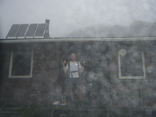
Although I relished the company and donations of tea and chocolate, I was itching to get a bit further before dark to make Sunday a short one. My feet became itchy after two hours in the hut… and before I knew it I was waving to my new friends from down the valley before disappearing into the bush again. But to my horror, when I finally made it to John Tait just before dusk, the hut was empty! This second contrast of the day, a very long day, made for a very lonely night. I set the fireplace ablaze to keep me company, the licking flames and crackling beech leaves my only amigos in the huge hut. I collapsed into my new Mountain Hardware Phantom 45 sleeping bag, enjoying all 500 grams of down powered warmth.

Warmth

Stage 6: John Tait -> Hopeless (1hr40)
As it turned out, the head-start I gave myself outweighed itself as a sleep-in. Well worth it. The green-moss goblin-like forest woke me up as I followed the Travers river downstream to the infamous Hopeless Valley.   Ironically, it really did live up to its name this time two years ago – heavy rains flooded the creeks and we were trapped an extra day – we escaped barely before Search & Rescue were called! So I started up the creek with trepidation, along with a huge dose of nostalgia and flashes of déja-vu.

Harry Hancock & co – Hopeless Hut founder

The creek was so low, a mockery to our epic survival battle back in 2009. Hopeless Hut had even had a makeover, the cracked windows and rusted sink replaced and shining new. This hut, one of my favourites in NZ, has rich history – and by some great fortune, when I arrived I met the Harry Hancock – the man who built the hut back in the 1950’s! It was opened by none other than Sir Edmund Hillary. Its vintage gives the shack real character, I find the new modern huts lack soul. But in the wilderness a roof is a roof! If its rainin’ you ain’t complainin’.

Stage 7: Hopeless -> Angelus (2hr50)
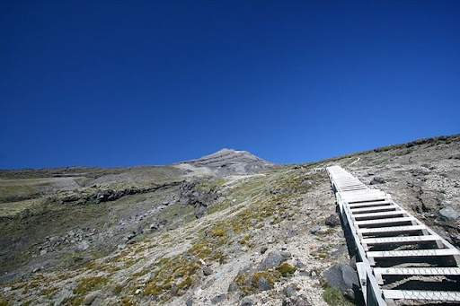
I gritted my teeth for my last hurdle – I reminded myself that from Sunset Saddle its all downhill to the finish. This was my mantra as I picked my way through the vaguely marked cairns up the the rugged scree basin. Not basin, ocean. An ocean of rock determined to sink my ankles and slow my progress towards the saddle surface. Deciding that the markers had been designed for people coming down from Sunset, I was all but left stranded in terms of navigation and had to decipher my own route up around the daunting waterfall face and around the misty alpine tarns.

Mountain Arena
Alone in this wild mountain arena now felt the most remote of all. It was overwhelming, and almost hard to breathe at times as my guts clenched in a sensation overload. Mist crept over the ledge I’d just climbed, and with it a jagged whiplash of chill forced me to a thermal for the first time. Again the extended effort of climbing almost 1000 metres from the valley floor, combined with low sugar levels was making me feel delirious – I gave up holding out for lunch at the hut, and stopped just below Sunset Saddle for a much needed boost. And that I did, I cut steps up the last snowy slope to finally reach the saddle, marked with a huge mound of rocks. Phew. From Hopeless to [the wings of] Angelus.

Stage 8: Angelus -> Robert Carpark (1hr50)
Feeling absolutely shagged by the time I stumbled into the new hut at Lake Angelus, the warden took pity on me and boiled me up a heavenly cup of tea. I had two. Of the five approaches to Angelus, the route via Sunset Saddle is the hardest and most untracked of all – in fact it’s not even marked on the map! Definitely the most satisfying though.

Warden gazes over the lake to Sunset Saddle
Now all that lay before me was 12km of snaking ridgeline over the open rolling tops to Mt Robert. The trail was rough as it sidled the notable Julius Summit, I skipped over plate-like shards of rock crumbling from the Roman’s terraces. At last Lake Rotoiti re-appeared, heralding the incredibly nauseasly steep, zig-zagging “Pinchgut” track. I collapsed in a heap at the car park, with no one else around except the beech trees towering around me, unfazed and unaware of the journey I’d just completed.

Descending the Pinchgut

It was hugely satisfying to conquer the whole Sabine-Travers circuit in just a weekend, and such a success that this may be the first of more multi-day runs to come. The “Solo Experience” was new and exciting, especially when tested out for the first time in the magnificent setting of Nelson Lakes. Though for every awesome moment of silence, there was always a tinge of loneliness. For safety’s sake I’ll keep solo trips at a minimum, as long as I can convince someone to join me – that means you!   

C’EST FINI
Run statistics
Distance: 74.2km (7km, 40km, 27km)
Vertical gain: 4733m
Max slope: 55% (Sunset Saddle route)
Huts: 8 (Speargrass, Sabine, W. Sabine, U. Travers, John Tait, Hopeless, Angelus, Relax Shelter)

Elevation Profile


.

St James Rogaine

For my third weekend based in Nelson I was keen to get out a bit further afield, beyond the bordering Richmond Ranges. Also, this weekend was rearing all over the country with mountain events – from the south, the glamorous Kepler Challenge 60km run in Te Anau. To the north, the infamous GOAT 21km around Ruapehu guaranteed to chew up your shoes, if not your soul. I had been looking forward to the Goat all year, but the Cook Strait proved too much of a logistical challenge. Plus, I was in the South Island already…

No Goat this year

I found my revenge in the form of the St James “Office Hours” 7-hour Rogaine held in the ranges beyond Hanmer Springs. Although I couldn’t find a team mate in Nelson, I didn’t give up. I took a gamble, and made the 300km journey to registration at St James Homestead hopeful, and nervous, to find a team… Success! The gamble paid off, I joined up with Elisha Nuttall and Joel Smith from Canterbury and Otago, and we made the ultimate team.

Elisha & Joel rearing to go at briefing
THE MAP

High above the steamy Hanmer Springs, we were now in real Canterbury high-country, and the most incredible terrain for a rogaine I’d ever seen. Take a patch of North Island farmland, add some towering 1800m mountain ranges and braided river valleys, and you get the idea. A nor-westerly was threatening us with rain so we packed for the conditions, carrying a stash of Gore-tex and merino. Joel scoffed at the briefing and repped a cotton tee-shirt, the whole day.

First up the first hill, foolish but necessary

9:30AM: The horn sounded. We darted up the nearest knoll-top for our first 10 points of the day. We were in the lead. Our strategy was to start out with some flat controls to start the day at a good pace, we headed north and pick up up 7 more controls without much trouble. The second most-valuable control in the far north had a pot of jelly-beans at the flag, we were delighted. To be my downfall or not, this lead to me ditching my salami sandwiches, chasing a sweet-toothed sugar craving all day. Only one hour had passed, how long would I last?

Jelly Beans. Yummy
Rugged high-country terrain

We had a horrible time finding #60 perched on a saddle above Horrible stream – I was convinced we were at the right saddle and high point combination, but there was good reason why the compass didn’t agree… Determined to make up time, we raced on to catch up the school team who had ashamedly crept past us.

Cresting the rocky spur to #70

After following the easy ridge up to Samoa Mound, we crashed down a scree slope into the valley heading west. We cruised through 5 easy controls, before filling up water in the DW stream. The terrain was extremely rough and made running hard at the best of times. We pushed straight up the hillside to collect #62, and while sidling round to the next stream gulley we met eventual winners Chris Forne and Nathan Fa’ave climbing in the opposite direction – clearing finding it hard work too!

Marshy, wide valleys to the west
Big scree covered slopes

With time ticking rapidly towards 7 hours, we had to start lowering our expectations, and we dropped four controls high on the St James range. We were saving our climbing energy for the big 100 pointer atop Peter’s Hill – number-one priority in our race plan. We cleared the swampy Peters Valley of the low controls and made a late dash for the summit! 1 hour 20 to go…

Battling the weather to summit Peter’s Hill

The rain that had held off all day finally made its presence known, and at 1100m above the valley plains we felt its full force. Joel, still hugging his cotton t-shirt and not much else, didn’t complain, all eyes were focussed on avoiding the prickly matagouri scrub and searching through the mist for the orange-white control flag. Boom – there it is: we punched our wrist bands and scrambled into the final stream gorge to find #72. The clue seemed straightforward: “Base of rocky outcrop/spur”.

Only a few obstacles before us to conquer

We spent 20 minutes of precious time searching the steep stream banks to find no said rocky outcrop – the 7-hour countdown was racing, find it or flee! One last desperate attempt for a valuable 70 points, we charged down the gorge to try and find it en-route to the finish checkpoint. There it was! For once it was the map who was wrong! By now we didn’t care, and battled through the shrub up & over the spur to descend to the road – five minutes to go – three of us ran the final kilometre towards the finish, with a generous helping of seconds left in reserve.

FINISH.
6:58:34

We almost cramped stiff after stopping in the rain. Back to St James homestead for a few moist sausages cake and tea – no better way to finish an awesome day in the hills. Even better was the luck of finding such mint team-mates – Joel & Elisha were solid all day – even though we’re spread across the country we’ll definitely meet up for some adventures in the future…

Nathan Fa’ave and Chris Forne powered their way through the course to pick up 1620pts from a pot of 1710. Impressive stuff from the adventure racing & orienteering champs. We were happy with our collection of 1200pts, and picked up an iced Christmas cake for our efforts. Thanks to Grant Hunter and the team at NZ Rogaine Association for organising such a sweet event.

Mount Hector


We woke from a luxurious twelve hour sleep in our campsite by Otaki Forks, already deep in the foothills of the tempestuous Tararua Ranges. When I stumbled out of the tent, I was disappointed. The brilliant sunset had been replaced with a billowing, brewing layer of cloud. Then I remembered the ranges’ reputation: the fog mountains, they were. All the more epic for a mountain run!

Camping at the trail start paid dividends, we hit the trail direct from our tenting field. Over the swingbridge and we instantly felt initiated into the ranges. There’s not much gentle about the place – a stiff climb greeted us from the offset and didn’t relent for several hundred metres of gravel-crusted ascent. Within minutes we were raised from the river-side plateau and were gazing through the gorged valleys of Otaki Forks.

It felt good. Today we were cutting into fresh, mountain blood. There’s nothing quite like venturing into a new mountain range; each step falling on virgin trail – we were excited. We soon climbed higher than volunteers could be bothered laying gravel – great-walk no more – a decisive transition into native Tararua forest and the run was now properly rugged. Beech leaves garnished the moist Greywacke, tangled in roots from warped Kamahi and Montane Podocarp. But whatever it happened to be, we puffed and ploughed over it, every drop of energy aimed at sending us higher and closer to the summit. Yes, the deadly Summit Fever was beginning to take hold.

Eventually we crested TiroTiro Knob and emerged out of the bushline to meet Field Hut. No ordinary hut, this was the first hut ever to be built in New Zealand, and is today one of nine hundred and sixty roofed siblings. It was built in 1924 by Tararua Tramping Club for the popular Southern Crossing trip traversing the ranges – the Wellingtonians obviously got sick of bivvying under canvas tarps every night. In a place this rugged I almost don’t blame them.

I took a quick geeze through the hut-book to find some familiar faces – Anton Gulley & Peter Luk’s small group of hardy AUTC mountaineers had come by this way in the deep snow of August.

We took a quick break to scoff down some Al’s Powerbars, thermal up in the chilling weather, then back to the game. The remaining subalpine Beech quickly wore thin and we were running through alpine tussock grasslands. Steering into thick fog with less than fifty metres of visibility, every change in the trail came as a sudden surprise – mostly in the form of a hill. Tough the climb was sporadic not a consistent uphill grind, giving us plenty of chances to stretch our legs over some quick going mountain marshes and the occasional knoll descent.

Now approaching Kime Hut and up to twelve… thirteen… fourteen hundred metres high the wind became ferocious and the rain followed suit, hammering into our thin jackets sideways. We were pretty glad for the shelter at Kime Hut: if I’d been going solo I’d probably have turned back at this point. It was gnarly. If some emergency struck, with only a thermal and jacket I was under-prepared for the harshness of this mountain. So close to Hector that we could taste it, we buffed up and primed ourselves for the last push. We topped and dropped Field Peak blocking us from the summit, then fronted up to the beast himself…

Our blood was pumping with anticipation of summit-dom. Matt led the assault to the memorial cross at the summit, I followed close behind, and swallowed hard when I heard his victory cry of WHAKA YEAAHH!!

HECTOR.
Mount Hector…
Toby stoked to reach the summit of Mt Hector

The weather was still atrocious at the peak, but our brains now well-marinated in toxic adrenaline – we revelled in it. Summit Fever had finally taken control. The two-metre high memorial cross was larger than I’d imagined – the plaque at its base commerates mountain-men who had died in the Great War. We breathed our last breath of summit, and set off the way we’d came, hoping to not suffer the same fate of those men. Hypothermia on this mountain was a real threat.

On the descent we passed a large group of school kids, Toby and Matt sprinted past giving them a shock but I stopped to find out they were from nearby Horowhenua College – I warned them to watch their step on this gnarly mountain, but I guess kids around here are bred tougher than in the north.

From there the job was all but done. Once back inside the sanctuary of the bushline we could relax and take shelter within the plush forest again. We sped through the long downhill, enjoying the openness of the bush, and though muddy it was very runnable – a refreshing change from dirty Ol’ Waitakeres. Every stride dowhill was a stride towards the warmer valley so we finally dried off and recovered after the pounding at Hector. At last at Otaki Forks we took a more adventurous route to the campsite along the Waiotauru River – with the rain it pushed a strong current that could be lethal with bad footing and a fall. Luckily we survived.

Exhausted,  we reflected back at camp on the incredible adventure. Gazing back towards the hills still hidden inn cloud, it was hard to imagine how rough it had been only an hour ago, over a thousand metres above. The Tararuas had proven themselves a foe worthy, and to be taken seriously. In hindsight we were lucky to have claimed the summit and escape unscathed.

Our next mission will be to repeat Graeme Dingle’s impressive traverse of the Tararua Range from North to South in twenty-four hours. Scanning along the topo map, for quite some time, we have our work cut out!

With the Summit Fever finally wearing off, we continued our journey south…

Definition: Sum~mit Fe~ver [suhm-it fee-ver] noun
Dillusional mental state experienced at high altitudes, usually experienced while climbing to a geographic high-point.
Symptoms may include:
-Compulsive desire to run or climb up steep hills
-Heightened sweating rate and deep breathing
-Loss of judgement, inability to turn back to base of mountain despite external warning signs
-Rise in frequency of cold head rushes, excitement, elevated heart-rate, extreme alertness
-Increased awareness of how awesome the universe is.
Now you’ve read the story, watch the short film: Mt Hector – The Movie.

Music: Requiem for a Dream – Clint Mansell


Mt Ruapehu Summit Run

Exams done and dusted, I farewelled my friends in Auckland and began my southward journey: The Big Move – to Nelson. I gathered some mates to join me on my traverse of the North Island, Matt Ogden and Toby Scott. Both excellent orienteers, we were sure not to get lost on the way, and also sure to capture the optimal route to Wellington. I lured them along to the road trip with promise of grand mountains; they weren’t disappointed. We were out of Auckland late so we literally didn’t stop until we hit the central plateau, where we tasted the sweet volcanic waters of Taupo Nui a Tia.
Arriving late afternoon we were only planning a short jaunt into the Kaimanawa Ranges to the east of the Desert Road… but seeing the snow flaked peaks of Ruapehu from Lake Taupo… oh so tempting… We spontaneously swung a right, and despite the warnings of DOC Turangi, slipped on running shoes at the Top-O-the-Bruce and began the climb up Mount Ruapehu. Inspired by the Swiss machine, Euli Steck, and his mesmorizing speed climb of the North Face of the Eiger, we were spurred on towards the summit.
We were surprised by the volume of snow still lying in the valleys of the northern side of the mountain, but from Iwikau Village we followed the rocky ridges and mostly stayed out of the snow for the first half. Matt separated himself at one point from us trying to take a quicker snowy route up one valley, but found himself faced with some serious rock climbing. Having watched Dean Potter free-basing the north face of the Eiger he decided he wasn’t quite up for it yet. 

It was gnarly running up the jagged spurs to the NZAC Alpine hut, but we pushed a solid pace, the fear of impending twilight hurrying us upwards. We gained the hut in a fifth of the time it took me to walk with pack and crampons in winter – such an awesome feeling – running light with minimal gear made the mountain seem so accessible, and with daylight-saving hours our chances of making the summit were looking great. Though lacking an ice-axe, we shot down the self-arresting practice slope with confidence knowing there was sufficient friction between the icy snow and our bare thighs… Phwoarrr.

Still climbing higher into the mountain, the rocks thinned out and we found ourselves trying to perfect our snow-running technique, something you get little practice with in Auckland. The drop into the popular Whakapapa Glacier was too steep to risk without ice axes, so we ascended Glacier Knob – a great route choice, a final surge through the saddle and we burst out onto the spectacular Summit Plateau. 2620m above sea level, we were the highest men on the North Island… Achieving our goal in just over eighty minutes, our minds were blown – on top of the world! Believe it or not, this was Matt’s first mountain experience. He’d been reluctant to try his hand at trail running, he felt naked without a map in hand. But now, he was convinced. A mountain running convert, to the rush of running high above the clouds…

The late evening mountain breeze was picking up so we didn’t hang around – a quick reccie up Cathedral Rocks peak and over to breathe in the tangy aroma of Crater Lake, before striding down the hospitable Whakapapa Glacier. Landing into soft snow on the way down made it feel inviting to heel-strike; Matt Ogden fell into this trap and felt the burn on his shins later. Toby meanwhile mastered the forefoot glide across the snow. We lost our height half the speed that we gained it, and soon we felt the pounding transition onto the jagged rocks again. Mist rolled up the valley, and stripped away our visibility – this made it difficult to pick the best route down; too lazy to get out compass or map I just winged it – and paid the price. I ended up approaching the ski-field village from the west, and so gifted myself a few extra valleys to climb up and over before joining the others at the car.

 The terrain here is remarkably rugged and its no wonder some of NZ’s top mountain runners gather in December to run the GOAT, a 21km race around Ruapehu’s crustiest flanks from Whakapapa to Turoa. Unfortunately I’ll miss the race this year, locked away in the mountainous surrounds of Nelson. 

Route to the Summit
Green – Fast, Red – Slow

Running to the Summit Plateau of Ruapehu was an incredible experience. For an area renowned mainly for the Tongariro Crossing, a trip that is only really worth doing in the snow, I’d recommend more people to have a crack at climbing Ruapehu. Given some basic mountain experience and skills, the summit is easily attainable and makes for an awesome day out. Enjoy the film below to the sound of Radical Face – ‘Welcome Home’.

Ruapehu – the Movie

Mokoroa Falls & Goldies Bush

After a hard day’s work studying Thermo-Fluids, Gene Beveridge, Tom Reynolds and I decided to take on some fluids of our own: the Mokoroa stream bash.
Tom approaches Mokoroa Falls

Nestled in the outskirts of Muriwai, the Mokoroa – Goldies Bush route is a solid circuit for an afternoon’s bash in the bush.

The descent from Constable Road to the stream has been upgraded so it is no longer as gnarly as it once was, and is now a sedate gravel bash unfortunately. Confusingly, to head up the Mokoroa stream from the junction, you turn right. The track loops underneath the bridge heading along the Goldie Bush Walkway.

Now the fun begins.
Gene and Tom were both repping the Inov-8 X-talon 212, a sensible choice as the track was greasy from the rain. Meanwhile I was left slipping through their hoofprints in my sleek pair of New Balance Minimus. I really like the Minimus trails, and even in the slippery conditions they forced me to keep my balance by other means; increasing my cadence and using the trail to my advantage. Basically grabbing onto trees and plants to avoid shooting off on a tangent into the stream!

 Along the upstream journey there were about ten crossings of the Mokoroa, some at rocky sections like the one above. The rock was covered in a devious layer of stream-grime. The crossings were OK today but after heavier rain they can quickly become raging torrents and can make the route pretty treacherous. I reminisced about travelling up this stream in the summer of 2010 during a midnight rogaine event; navigating was definitely easier in the day time!

Start and finish at Constable Rd (far left)

Left: Mokoroa Falls from the viewing platform.   Right: Tom charges down the muddy Goldie Bush track

The Goldies Bush Walkway was a mud-fest, luckily it was a downhill so we let gravity take care of business down to the bridge. All that was left to finish is the uphill grind to the car, a humbling experience, I let the stairs finish me off, and felt smashed at the top. A very decent track, and a quality low-key adventure. I especially loved the Mokoroa stream route – high adrenaline stuff when done at race pace, and a lot of tricky terrain to negotiate. Get out there and give it a go! This run would be paradise on a hot summer’s day.

The entire run took us about 70 minutes. The upcoming Speight’s West Coaster adventure run takes in this section as part of the Marathon event, starting at Bethells Beach on 26th November. Including the Te Henga trail and a lap of Lake Wainamu, this race is a real challenge – good luck to the brave!